Location
40 km W of Hwy 91450 km NE of Patuanak, SK
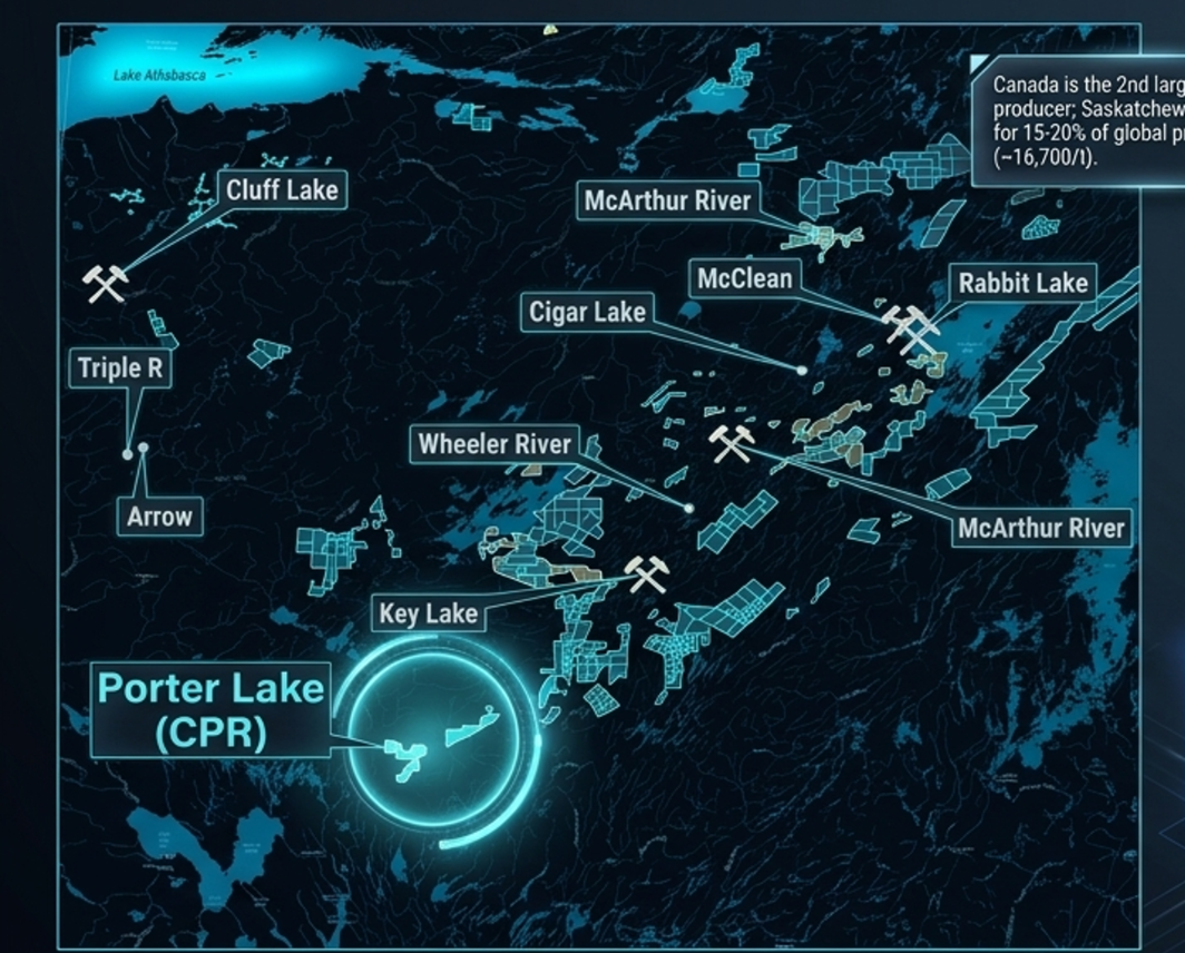
01Porter Lake · Saskatchewan
On the southwest Wollaston‑Mudjatic transition zone, on trend with the largest discoveries in the Athabasca basin.
02Snapshot
03The targets
Each target has its own geological merit, historical evidence, and a defined Phase 2 drill allocation.
04The geology
Porter Lake hosts both classic Athabasca fault‑hosted targets and large‑scale Rossing‑type granitoid targets.
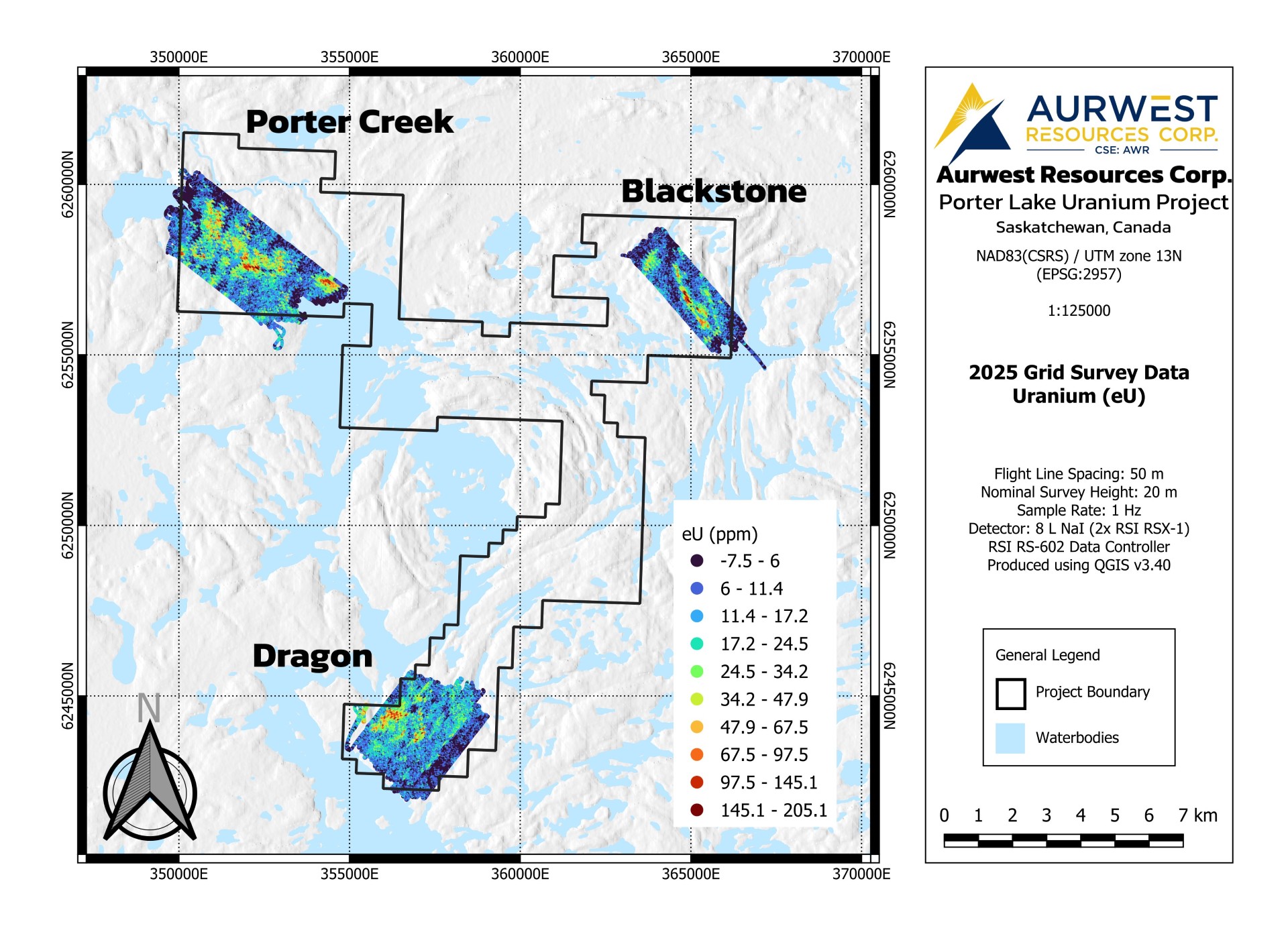
Uranium hosted in large granitic formations. Global Rossing‑type deposits typically grade 0.04–0.07% U₃O₈. Porter Creek surface samples already grade up to 0.58% U₃O₈ — an order of magnitude above the global Rossing range — across a 2.9 km exposed granitoid corridor.
Concentrated uranium along shear zones, faults and electromagnetic conductors. Historical EM conductors run through Blackstone and Dragon. 1950s drilling at Blackstone hit 0.20% U₃O₈ over 1 ft but missed the main conductor. RAMP‑HD 2025 mapped uranium directly along that conductor.
05De‑risking · RAMP‑HD
Helicopter‑borne gamma‑ray spectrometry mapping U, Th and K signatures at 50 m grids. Zero ground footprint. Survey completed September 2025. Aurwest steps in past the airborne phase — three drill‑ready targets in hand.
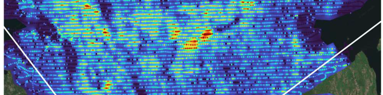
Continuous U / Th signatures in exposed granitoid along a 2.9 km corridor.
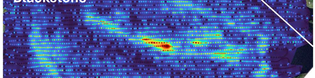
Uranium mapped directly along the EM conductor the 1950s drill missed.
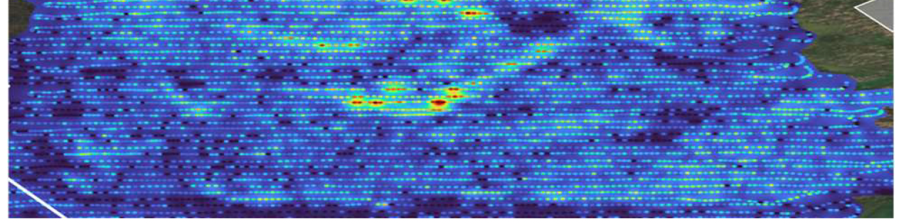
Granitoid + lake‑edge anomalies on a max‑min conductor.
06Weaver Lake · British Columbia
Optioned from Pacific Bay Minerals (TSXV: PBM). Aurwest can earn up to 50% over three years.
Definitive option and joint venture agreement executed April 14, 2026. Aurwest can earn up to a 50% undivided interest over three years through cash payments, share issuances, and exploration work commitments. Upon Aurwest satisfying all option payments and work commitments, the parties automatically form a 50/50 joint venture.
Orogenic gold‑silver mineralization in structurally controlled quartz‑carbonate vein systems. Multi‑gram Au/Ag drill intercepts over metre‑scale widths; trench sampling up to 63.77 g/t Au and 2,009 g/t Ag. Secondary upside in magmatic Ni‑Cu sulphide (Pacific Nickel / Giant Mascot analogue).
Maps, grades, RAMP‑HD imagery and the work plan. Detailed targets, peer reserves, and capital structure.